The Invisible Force Shaping The Great Plains
Beneath the surface of the central and southern great plains, a placid aquifer of water controls the future of agriculture production.
For millions of years, water has shaped the landscape of the western United States. The Missouri River feeds millions of acres of fertile farmland; the Great Salt Lake summoned civilization to the desert; and the Colorado River carved out the Grand Canyon. The future of the American West is now being shaped by an invisible source of water — aquifers.
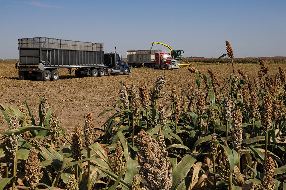
While the water from aquifers doesn’t move above ground with the force required to erode rock, farms in the Great Plains are changing. The Ogallala Aquifer, which provides nearly all the groundwater in western Kansas and Oklahoma, the Texas Panhandle and eastern New Mexico, is drying up faster than it can be replenished.
Experts have sounded alarm bells for the Ogallala Aquifer for decades. Since the advent of center-pivot irrigation in the 1960s, thirsty row crops like corn have drained parts of the aquifer faster than it can be replenished. In arid climates like Kansas, Oklahoma, Texas and New Mexico, center-pivot irrigation is the most profitable way to produce row crops. In many areas, 80% to 90% of the permitted groundwater from the aquifer goes to irrigation.

Managing An Invisible Resource
Unlike the interstate highway system that is overseen by a federal agency, the water in the Ogallala is managed state-by-state. Each state is empowered to determine the best way to allocate water rights and manage water resources within their boundaries.
Managing a largely invisible resource like an underground aquifer presents some challenges. Brownie Wilson is well versed in Kansas’ groundwater dilemma. He’s a water data manager at the Kansas Geological Survey (KGS) in their geohydrology division. Given the natural variability in the subsurface, Wilson doesn’t call water-level declines a crisis in all areas, but he won’t minimize the significance of the issue in the state either.
“Sometimes you have a water permit and there’s no water there to use. We call this ‘paper water,’ because the water was there at one point and today it’s not,” explains Wilson.
It’s a challenge Bret Riley, a rancher in New Mexico, watched several farmers struggle with in the 1980s when he started his career with Federal Land Bank.
“My job was up at Clovis, New Mexico, and that’s kind of on the edge of the aquifer,” says Riley. “We were seeing some wells go dry just northeast of town. Producers were put in some bad situations where they were carrying a debt load for irrigated production, but they didn’t have any irrigation water.”
Some wells have run dry, but other areas are luckier. That’s because the bedrock beneath the aquifer is more like an egg crate than a level floor. Some areas have deep pockets of groundwater, while others are shallower.
Part of Wilson’s job is collecting aquifer data for Kansas. Every January since 1996, staff members at KGS and the Kansas Division of Water Resources (DWR) collect hand-measured readings from over 1,400 wells to track the water levels of the aquifer. With this point-in-time data, Wilson has been able to identify places where the aquifer level is declining, increasing and staying level.
“Groundwater is not declining everywhere. But the western third of our state is the Ogallala-fed portion, and that typically is in a state of decline,” he says. Most estimates at the turn of the 20th century called for producers to reduce their water use by 80% to 90% to restore balance to the aquifer. However, modern technology has changed that assessment. In the last 15 years, the KGS staff has installed electronic sensors that record water levels every hour in a growing number of wells. This network of wells providing real-time data is helping researchers paint a less daunting picture.
“What we’re finding is, the number to stabilize water levels in many areas of the aquifer for the next decade or two is not nearly that big. It’s more like a 20%-30% reduction in the use than we’ve seen in the past. That’s one of the messages we’re trying to relay out to people,” says Wilson. Although he acknowledges some areas may still need 40% to 50% reductions, he is hopeful these lower reduction numbers are more in line with what’s possible.
Shaping The Landscape From Below
Thirty-five years ago, Riley recalls driving from the farm he grew up on in Estancia, New Mexico, to Texas Panhandle towns like Muleshoe or Lubbock to pick up tractor parts or tools anytime a harvester broke down. He recalls miles of cornfields coloring his drives then.
“Now I go into that same country, and I still see a lot of pivots, a lot of irrigation is still going on, but they don’t have enough water to grow corn anymore. They’re growing cotton and wheat. And they’re having to tie two or three wells together to make one pivot run,” he observes.
Gina Gigot manages an aquifer-fed farm near Garden City, Kansas. Before her father passed away in 2015, Gigot remembers him telling her how important it is to conserve water on the farm.
“As he sat there, watching that the aquifer was dropping and dropping, and so he told us early on, probably 2010, 2012, he said this piece of property has some rechargeable areas to it, but we’re going to have to take care of it,” she recalls of her late father’s advice.
Gigot’s father started their family farm in the early 1970s with 300 center pivots. Through selling off pieces or decommissioning pivots, Gigot’s father left her brother and her a farm that looked quite different from the one he bought.
The Gigot siblings followed their father’s lead in balancing water use and profitability. In 2017, Gigot harvested her last row crop. Today, the remaining 60 center pivots irrigate forage for her new cow-calf enterprise.
“Basically, we put a new outlook on life,” says Gigot. “We don’t do any more row crops. Everything we do here is either grazed, ensiled or pastured. And that’s our way of making the water conservation work for us.”
Her mindset made change part of their farm’s management plan. But other farmers aren’t as comfortable with trying new enterprises. That hesitancy is widespread and tends to thwart the efficacy of conservation efforts like Gigot’s.

Finding Ways To Conserve
As experts and producers investigate options for long-term stabilization of the aquifer, they all point to agriculture as the catalyst for change. But historically, change isn’t a mindset the industry quickly embraces.
The most effective approach Wilson has seen for stabilizing water levels is collective action within a region. To that end, the Kansas DWR facilitates two voluntary action programs: Local Enhanced Management Areas (LEMAs) and Water Conservation Areas (WCAs).
After a failed attempt to rally support for a LEMA in her community in 2017, Gigot met with her local DWR office to create a conservation area for her farm.
“You say ‘this is what I think I’m capable of doing,’ and basically what it amounted to is we put together a five-year plan that we would save 17% off our allotted acre-feet,” explains Gigot. “At the end of that five years, we ended up saving almost 26% off our allotment. We went over and beyond what we said and basically banked that acre-feed to use in the future.”
To get there, Gigot switched to lowflow nozzles on her center pivots that took their capacity down from 1,000 to 500 gallons per minute. She learned to manage her forage production with what she had, which meant understanding when a crop can make the most efficient use of irrigation, and she could shut down a pivot without harming the forage. She also used rotational grazing to stimulate forage production and improve soil moisture retention.
In New Mexico, there’s a novel solution in the works to incentivize producers to de-commission wells. The Ogallala Land & Water Conservancy in Clovis launched a pilot project in 2022 that paid landowners through a water rights lease agreement to leave 80% of their water allotment in the ground.
“Since we shut off these wells in 2022, we have made three lease payments to our eight landowners, soon to be nine,” says Ladona Clayton, executive director of the conservancy. “We saved almost 8 billion gallons of groundwater in just two years. By the end of 2025, with additional wells now decommissioned, it’s going to be 13 billion.”
Clayton believes the pilot project, which is transitioning into a long-term program, is replicable in other communities. But she admits it took some wrangling of state and local agencies, and even the federal government, thanks to the involvement and financial support of nearby Cannon Air Force Base, to get the project off the ground.

Established avenues that support producers in reducing their water use are scarce, likely because they face the same daunting task Clayton did in Mexico two years ago. But with a resource as precious as water, states and producers will be forced to get creative to find solutions.
Back in Kansas, Gigot thinks of her water as a savings account. A gallon saved is a gallon earned for the future. She’s constantly looking for ways to maximize water efficiency through planting different varieties or monitoring forage response to watering times, but she worries about the state of the aquifer as a whole.
“When you take all of western Kansas, there’s a lot of areas that are really making a lot of changes. But in southwest Kansas, they haven’t been as aggressive. You know, change is hard on people, and especially if you’re a third- or fourth-generation corn farmer,” Gigot says.
Riley thinks crop subsidies disincentivize farmers from reducing their cotton or wheat crops despite repeated poor or nonexistent harvests. He believes we need a better solution, something that balances the needs of farm families today with the needs of the next generation.
“The young people that are coming in behind us, they’re the ones that are going to pay the price of us utilizing all the natural resources. I think we have a duty to go in there and figure this problem out and have enough gumption to carry it through,” he says.
With a variety of depths across the aquifer, the timeframe for how long the water will remain viable can only be determined well-by-well. Experts are hesitant to attribute any time-table at all.
Nothing can resist the pursuit of water; fine flakes of chalk on a sidewalk, concrete dams and corn fields all succumb to water’s whim. Producers know that weather – especially rain – is one of the many things out of their control.
Water is one of the most powerful forces that shapes the Earth. Even when it lies placid below the surface, water, or lack of it, controls the livelihoods of all those above.

Laura Brenner
Laura Brenner, Sr. Content Writer
Laura Brenner is a senior content writer for Noble Research Institute. She’s worked in agricultural communications for over a decade, specializing in nonprofit communications and storytelling. Laura earned a bachelor’s degree from Penn State University and a master’s degree from Purdue University. She resides near her hometown of Lancaster County in south-central Pennsylvania.

Comment